Learning Futures Architect
in 3D / Data Visualization / Design / Education / Learning by Doing at HCT / Technology / Uncategorized
You may also like
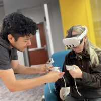
Exploring the Future of Learning Technologies: Oregon State University and NVIDIA Visit ASU Next Lab
Hosted colleagues from Oregon State University and NVIDIA at ASU Next Lab this week. The visit focused on emerging intersections...
December 19, 2024
Search
-
Education / Featured / Next Lab at ASU
ASU’s Next Lab charts the future of skills and tech
October 11, 2023
-
Conference Speaker / Education / Featured / Next Lab at ASU
The Arc of Truth and the Right to Be Curious
March 19, 2025
- 3D abu dhabi agisoft AI ar ARstudio asu augmented reality CTL data visualization dataviz digital-heritage dronesforgood dubai extended reality Fenn garmin HCT ideapaint innovation INSPIRE inspiredu2 JCU learning spaces lfc Mindspan NGLSAsia PhD photogrammetry photoscanpro singapore SketchFab small group worksheet solar SOLO sooc T&L teaching and learning center TLC tropicalcoast UC university of canberra workshop xr zu


